veeeenha que te ensino como é que se reclama .
OBRIGADA A VOCÊ QUE RECLAMOU AGORA SEI O FÉU QUE VOCÊ É, DEVIDAMENTE LARGADO NO LIXO!
EU TENHO AQUI 25 MIL ENTRADAS ESTÃO NO BLOQUEADO IDIOTA!
MAS É CONCESSÃO REPASSAR. PARA QUEM SE INTERESSA! ESTUDE E FAÇA QUALQUER MERDA! QUEM SABE VOCÊ CONSEGUE.
LEIA. EU CRESCI NUMA CASA COM 10 MIL LIVROS E LI OS 10 MIL LIVROS.
JÁ LEU FREUD, JUNG, E WILLLIAM HEISCH? POIS É RECOMENDO PRINCIPALMENTE:
- ESCUTE ZÉ NINGUÉM
lá eu fiz 300 mil pessoas .Me procure em Badagas! 😉
Foi feito o resgate, e lançado tudo que era possível.
Documentos, história, etc.
Os que não entendem e tem problema de cognição , tá certo primo = burrice cronica, fazem as merdas que fazem. Rs.!
QUERO CRIAR PRECEDENTE.
o que você não le mais é porque eu passei para privado.
por causa da turma de reclamão.
da turma que não faz só reclama e fode com as pessoas.
================================================================
República Jornal de Santa Catarina (não peguei ) só 1
http://hemeroteca.ciasc.sc.gov.br/republica/republica%201898%20a%201899.html
================================================================
Genealogias das ilhas Madeira e Porto Santo, João de Ornellas de Vasconcellos
https://archive.org/details/d2ebf30f-51c7-4c0b-9aa9-2b68a721a141/page/n48/mode/thumb
================================================================
LES FLORENTINS A LYON LES FLORENTINS EN POLOGNE
https://archive.org/details/cnh-2320b-2211686-1/page/n42/mode/thumb
================================================================
Genealogia de famílias portuguesas. - Antes de 1737., delícia Manuscrito!
https://archive.org/details/cod-1037_0000_capa-capa_t24-c-r0150_202307/page/n12/mode/thumb
================================================================
https://gallica.bnf.fr/ark:/12148/btv1b525032167?rk=21459;2
https://gallica.bnf.fr/ark:/12148/btv1b525032167/f1.item
================================================================
BUSCA POR JOÃO TEXEIRA SÃO 65 PÁGINAS COM 15 RESULTADOS CADA
(UMA PENA JÁ SEI QUE VOCÊ ENTULHO NÃO CONSEGUE FAZER)
https://gallica.bnf.fr/services/engine/search/sru?operation=searchRetrieve&version=1.2&query=%28gallica%20all%20%22Jo%C3%A3o%20Texeira%22%29&lang=fr&suggest=0
================================================================
================================================================
42 phot. de sites et surtout de types ethniques des îles
Mariannes et Carolines par A.A. Marche, donateur en 1890, PHILLIPINAS
https://gallica.bnf.fr/ark:/12148/btv1b532736939#
================================================================
Atlas universal / de Diogo Homem ; dir. Manuel Moleiro Rodríguez. -
Barcelona : M. Moleiro Editor, S.A., 2000. - 19 p. de mapas : color.; 50 cm
não acessa
https://permalinkbnd.bnportugal.gov.pt/records/item/14404-atlas-universal?offset=2
================================================================
Procurando por Pedro Manrique
https://gallica.bnf.fr/services/engine/search/sru?operation=searchRetrieve&version=1.2&query=%28gallica%20adj%20%22Pedro%20Manrique%22%29&lang=fr&suggest=0
================================================================
https://gallica.bnf.fr/services/engine/search/sru?operation=searchRetrieve&version=1.2&startRecord=0&maximumRecords=
15&page=1&query=%28gallica%20all%20%22Wavrin%22%29&filter=dc.type%20all%20%22manuscrit%22
Les voyages et conquestes des roys de Portugal ès Indes d'Orient,
Éthiopie, Mauritanie d'Afrique et Europe...
Le tout recueilly de fidèles tesmoings et mémoires du sieur Joachin de Cen
https://gallica.bnf.fr/ark:/12148/bpt6k8704895s/f5.planchecontact
AQUI TEM VÁRIOS LIVROS DE 1500 PARA LER ESTUDAR E BAIXAR
====================================================================
AQUI! IMAGENS FOTOS PINTURAS DESENHOS
Wien Museum , On Line Sammlung!
aqui o Principe Alemão! aquele que estava sorrindo!
AQUI OS ASCENDENTES DELE
https://sammlung.wienmuseum.at/en/search/?fullText=F%C3%BCrstenberg&sort=RELEVANCE&layout=NORMAL
https://sammlung.wienmuseum.at/en/search/?fullText=+Maximillian+Egon+zu+F%C3%BCrstenberg&skip=60&sort=RELEVANCE&layout=NORMAL%20https://sammlung.wienmuseum.at/en/search/?
====================================================================
Plano de Madri
Plano de Madrid. 1 : 12 500 Edicion del Año de 1848 / Grabado en Madrid bajo la
direccion de D. Juan Noguera
https://gallica.bnf.fr/ark:/12148/btv1b8492465w
====================================================================
4984 results for Batalha de Aljubarrota (só que não o que buscou 4984 foi a palavra Batalha)
https://sammlung.wienmuseum.at/en/search/?fullText=+Batalha+de+Aljubarrota&sort=RELEVANCE&layout=NORMAL
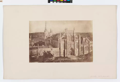
Portugal, Batalha, Kloster von Batalha / Mosteiro de Santa Maria da Vitória
https://sammlung.wienmuseum.at/en/object/977859-portugal-batalha-kloster-von-batalha-mosteiro-de-santa-maria-da-vitoria/
Portugal, Batalha, Kloster von Batalha Mosteiro de Santa Maria da Vitória
====================================================================
Vues stéréoscopiques de Victor Ninet. Océanie (îles Mariannes et Philippines)]
https://gallica.bnf.fr/ark:/12148/btv1b52524386g
====================================================================
Plans de villes d'Espagne et du Portugal já no sistema waybachMachine
Archive.li Archive.org
https://gallica.bnf.fr/ark:/12148/btv1b525240529
====================================================================
Peninsula española / por don Francisco Coello l já no sistema waybachMachine
https://gallica.bnf.fr/ark:/12148/btv1b532234841
====================================================================
Peninsula española / por Don Francisco Coello não peguei tem vários planos , mapas, imagens
https://gallica.bnf.fr/ark:/12148/btv1b53156502w
====================================================================
Manille (Philippines)
https://gallica.bnf.fr/ark:/12148/btv1b8447088p
====================================================================
[3 phot. des Philippines par A.A. Marche, donateur en 1886]
https://gallica.bnf.fr/ark:/12148/btv1b532736795
====================================================================
Guerre de la succession d'Espagne (1701-1714) -- Opérations militaires -- Gibraltar
Plan de Gibraltar avec les retranchements faits par les troupes de Sa Majesté Catholique devant cette place le 18 janvier 1705
https://gallica.bnf.fr/ark:/12148/btv1b53290127w
====================================================================
Plano geometrico de la bahia de Algeciras y Gibraltar / levantado p[o]r D.n Vic.te Tofiño de S.n Miguel não foi para o waybach Machine ou archive.org
https://gallica.bnf.fr/ark:/12148/btv1b53290118x
====================================================================
começar aqui no dicionário
Diccionario geografico-estadistico-historico de España y sus posesiones de Ultramar. I. A-Al / por Pascal Madoz 1846-1850
https://gallica.bnf.fr/ark:/12148/bpt6k940974h/f7.planchecontact.r=%22Pedro%20Manrique%22
https://gallica.bnf.fr/ark:/12148/bpt6k940974h/f7.planchecontact
====================================================================
Pedro Texeira Albernaz
https://gallica.bnf.fr/services/engine/search/sru?operation=searchRetrieve&version=1.2&query=%28%28dc.creator%20all%20%22Albernaz%2C%20Jo%C3%A3o%20Teixeira%22%20or%20dc.contributor%20all%20%22
Albernaz%2C%20Jo%C3%A3o%20Teixeira%22%29%29&keywords=Albernaz,%20Jo%C3%A3o%20Teixeira&suggest=2
https://gallica.bnf.fr/services/engine/search/sru?operation=searchRetrieve&version=1.2&query=%28%28dc.creator%20all%20%22Albernaz%2C%20Jo%C3%A3o%20Teixeira%22%20or%20dc.contributor%20all%20%22
Albernaz%2C%20Jo%C3%A3o%20Teixeira%22%29%29&keywords=Albernaz,%20Jo%C3%A3o%20Teixeira&suggest=2
====================================================================
aqui São Pedro do Rio Grande do Sul
https://gallica.bnf.fr/ark:/12148/btv1b8596736p?rk=257512;0
O Rio Grande he hum dos melhores de toda a Costa de Brazil
por Joao Teyxeira
====================================================================
Portugal Reduit d'une carte à la main de Texeira géographe de S. Mté. Portugaise en 1659
https://gallica.bnf.fr/ark:/12148/btv1b532672017/f1.item
====================================================================
obaaa aqui um livro com várias cartas mapas antigos
https://gallica.bnf.fr/ark:/12148/btv1b550101920
====================================================================
A new chart of the coast of Brazil : from the banks of St. Roque, to the island of St. Sebastian.
https://gallica.bnf.fr/ark:/12148/btv1b53123129c
====================================================================
https://gallica.bnf.fr/ark:/12148/btv1b550101920/f39.item
====================================================================
Atlas ou recüeil de cartes geographiques, dressées sur les nouvelles observations de M[essieu]rs de l'Academie Royale des Sciences, par N. de Fer geographe de sa Majesté Catolique et Monseigneur le Dauphin
====================================================================
A new chart of the coast of Brazil : from the banks of St. Roque, to the island of St. Sebastian
https://gallica.bnf.fr/ark:/12148/btv1b53123129c
====================================================================
Mapa antigo de Fernando de Noronha
https://gallica.bnf.fr/ark:/12148/btv1b53177600b
====================================================================
atlas do Mundo 1600
[Atlas nautique du monde] / [par Honoré Boyer
https://gallica.bnf.fr/ark:/12148/btv1b525195928
====================================================================
Carte nautique de l'Océan Atlantique, de la Méditerranée et d'une partie de l'Océan Pacifique] / Dominguos Sanches a fes em Lisboa anno 1618
Toscane, Grand-Duché de -- Divisions politiques et administratives Sanches, Domingos
https://gallica.bnf.fr/ark:/12148/btv1b8493704j
====================================================================
[Carte nautique de l'Océan Atlantique, de la Méditerranée et d'une partie de l'Océan Pacifique] / Dominguos Sanches a fes em Lisboa anno 1618
https://gallica.bnf.fr/ark:/12148/btv1b525215470
====================================================================
Carte du Monde de Otto Progel
https://gallica.bnf.fr/ark:/12148/btv1b52523067m
====================================================================


,_soprano_au_Th%C3%A9%C3%A2tre_des_Folies-Dramatiques_en_1877._PH56574.jpg)